Lauterbach solar park
ENERPARC AG's Lauterbach solar park is located around 0.5 kilometres south of Frischborn and 1.5 kilometres north of Rixfeld. With an area of 46.4 hectares, it is one of the larger plants in our study. The first construction phase was commissioned in January 2022, followed by the second in May of the same year.
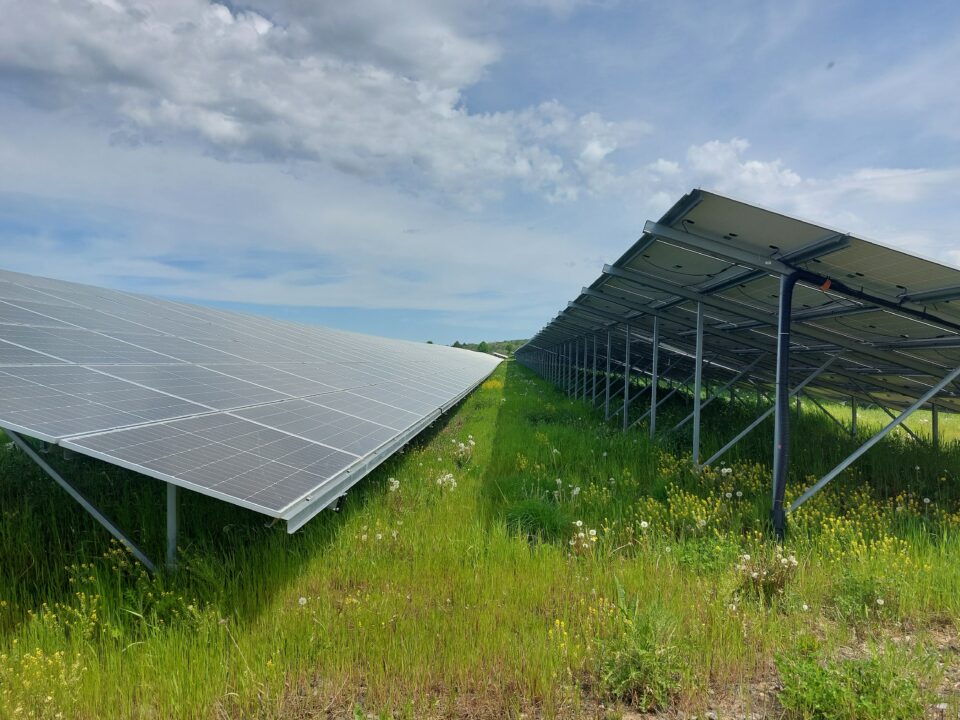
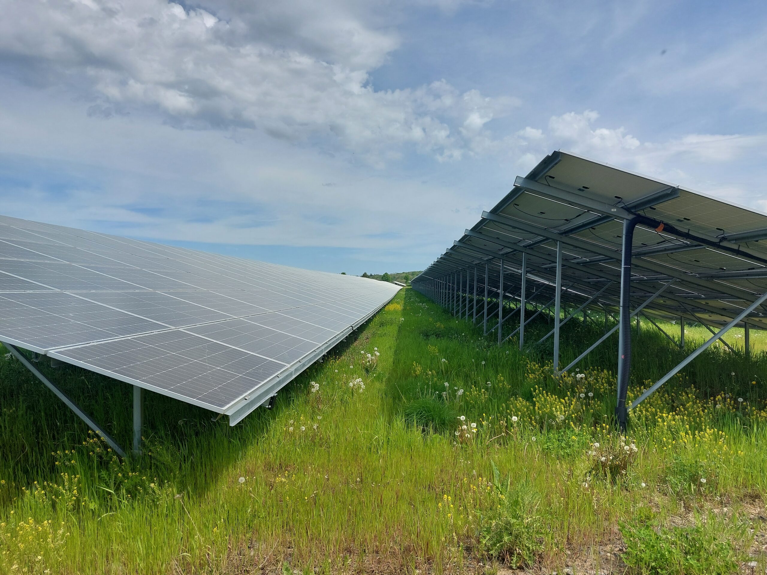
The relatively young solar park is characterised by sometimes wide gravel paths and extensive, dense ruderal vegetation. Other special features include backwater areas (rainwater) below some rows of modules, stone bars, piles of stones and sand and successively growing herbaceous meadows.
ENERPARC AG
54.7 MW
46.4 ha
2022
Hesse
50.5958821893 - 9.37046656066
Arable land
Table of contents
| Species groups | Investigated |
|---|---|
| Plants | ✔ |
| Locusts | ✔ |
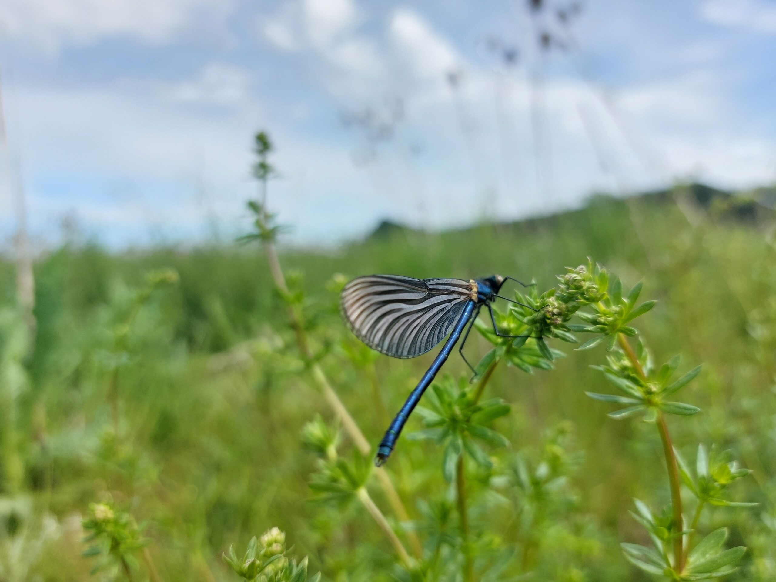
| Butterfly | ✔ |
| Dragonflies | |
| Reptiles | ✔ |
| Amphibians | |
| Birds | ✔ |
| Bats | ✔ |
| Miscellaneous |
✔ = Investigation carried out on behalf of the operators
Natural environment and special features
East Hessian highlands (Vogelsberg and Rhön)
The area is located in open land and is surrounded by intensively utilised agricultural landscape. To the east and south, the site is partially bordered by rows of trees and hedge structures. To the south of the site is a group of old oak trees. Adjacent to this are arable fields and meadows, which are crossed by the course of the Eisenbach stream. The Auhof farm is located to the south-west of the site.
The solar park is located approx. 10 kilometres north-east of Oberwald. The site has its highest point at 435 metres above sea level and drops to around 424 metres to the south-west.
Mostly arable land (species-poor field biotope with open land character), also small-scale grassland areas with scattered individual trees and shrub hedges. The FFH area "Lauter and Eisenach" is located nearby. For more details, an inventory map of the biotope and utilisation types is included in the appendix of the environmental report.
Floor
Brown earth / pseudogley from loess loam containing basalt crust
Clay slurries
Construction method
0.6
2.5m
1.2m
18°
6 pieces
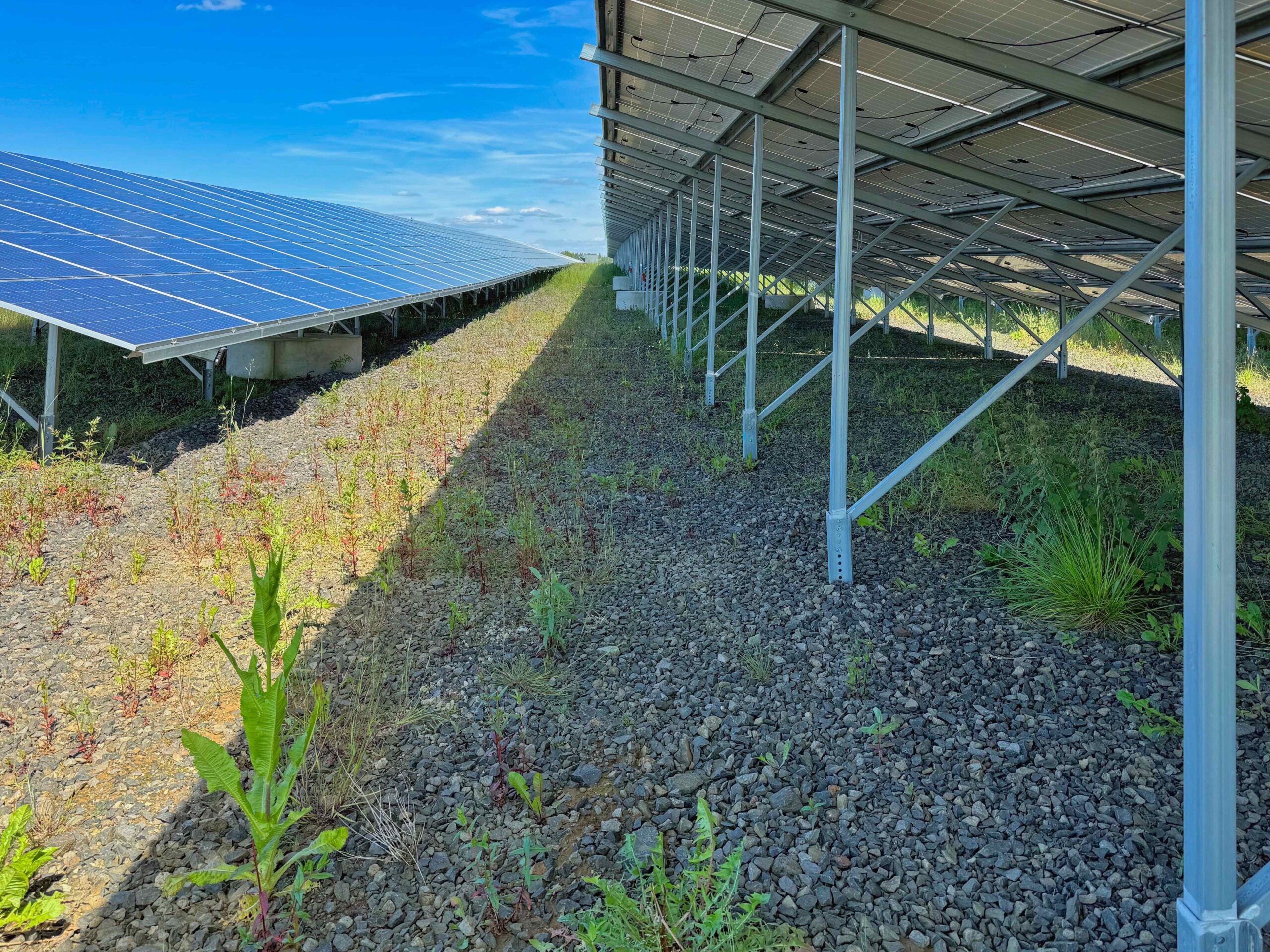
The frames are anchored to the ground by pile-driving posts fitted with support struts.
Monofacial modules were installed.
Gravel paths were laid in the area.
The Lauterbach solar park has its own transformer station, a mini storage facility (miniBess) and drainage ditches with strips of water at the edge of the ditches.
Management
The site is maintained by a mulcher (as of December 2024). The mulching is a compromise until the planned grazing is finally established.
Equalisation measures
The following measures were implemented:
- Development of meadow areas
- Development of flowering and old grass strips
- Creation of a migration corridor
- Preservation of avenue trees
- Planting of hedges (pending)
- Reduction of solar park areas by means of a contract
- Creation of stone bar complexes
- Creation of sand lenses
- Preservation of perennial grass strips
- Development of 0.5 ha of flowering areas as a compensation area for the skylark


Test results
Further documents
Development plan
Lauterbach solar park development planEnvironmental report
Environmental report Lauterbach solar parkInfo flyer
Info flyer Solarpark LauterbachMonitoring report for breeding birds (2022)
Monitoring report for breeding birds (2022) Lauterbach solar parkMonitoring report for breeding birds (2023)
Monitoring report for breeding birds (2023) Lauterbach solar parkMonitoring report for breeding birds (2024)
Monitoring report for breeding birds (2024) Lauterbach solar park